

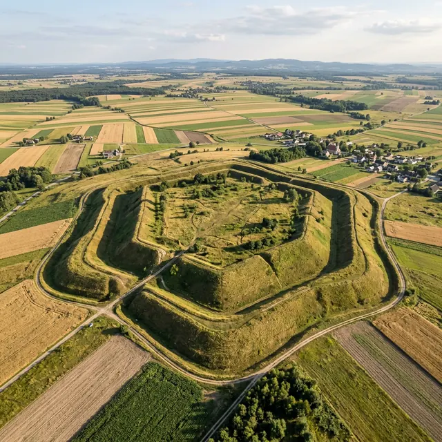
The stronghold site at Stradów
Stradów, Zamczysko, outer settlements Barzyńskie, Mieścisko and Waliki
One of the largest strongholds in Poland, on a hill between Chrobrze and Skalbmierz. It consists of a pentagon-shaped stronghold and three outer settlements, about 25 ha in all. The ramparts, surrounded by a dry moat, are up to 18 m high. The rampart of one of the outer settlements was dated to around 898-913.
How certain this knowledge is
Confirmed in sources
How we know about this
Archaeological research by Stefan Nosek (1956-1963) and later; dating of the ramparts to the 10th-11th centuries.
What people believed
The stronghold was active only briefly, from the mid-10th to the middle or late 11th century. It may have been founded in the days of the Vistulans and later belonged to the Piast state. It burned down in the mid-11th century, and its role was taken over by Wiślica.
Where
Stradów, Czarnocin municipality, Świętokrzyskie voivodeship
Fun fact
In good weather the Beskids can be seen from the top of the ramparts. Information boards often call Stradów "the largest stronghold in Poland", but this description has no reliable source.
The image is an artistic vision based on archaeology and descriptions, not a faithful copy.